Jan Olsman, Aalto University, jan.olsman@aalto.fi
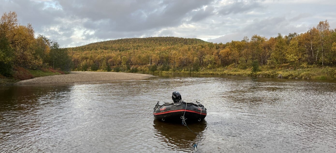
Even though the core of my research is conducted behind my laptop screen, you will frequently find me outside, standing in rivers. Together with a great and dedicated team, we try to install and maintain our equipment and get seasonal measurements on hydrologic processes. We generate data that will feed our digital systems so that we can learn about physical processes and understand the complex, but critical, river systems here in Finland, and elsewhere. It is my job to connect our work outside to scientists and experts on hydrologic models, stakeholders, and others.
What we do in our field campaigns
Finnish rivers know a strong seasonal variation: low-flow autumns, frozen winters, and high-discharge springs. The climate is the most important factor in determining the rivers’ seasonal discharge regimes. Currently, with anthropogenic climate change, these discharge regimes will likely change. Milder winters will result in less ice-cover, warmer temperatures will shift spring floods earlier in the year, and discharge in summer and autumn will decrease even further. But the models show spatial variation in climate effects on the rivers. It is crucial to increase our understanding of the forcing processes in these critical systems. The sometimes-harsh environment in these high-latitude, cold-climate rivers makes data collection difficult. There is a historical lack of data on hydrologic parameters; new observation methods and technological advancements make it even more important for us to get out in the field and try to measure as much as possible.
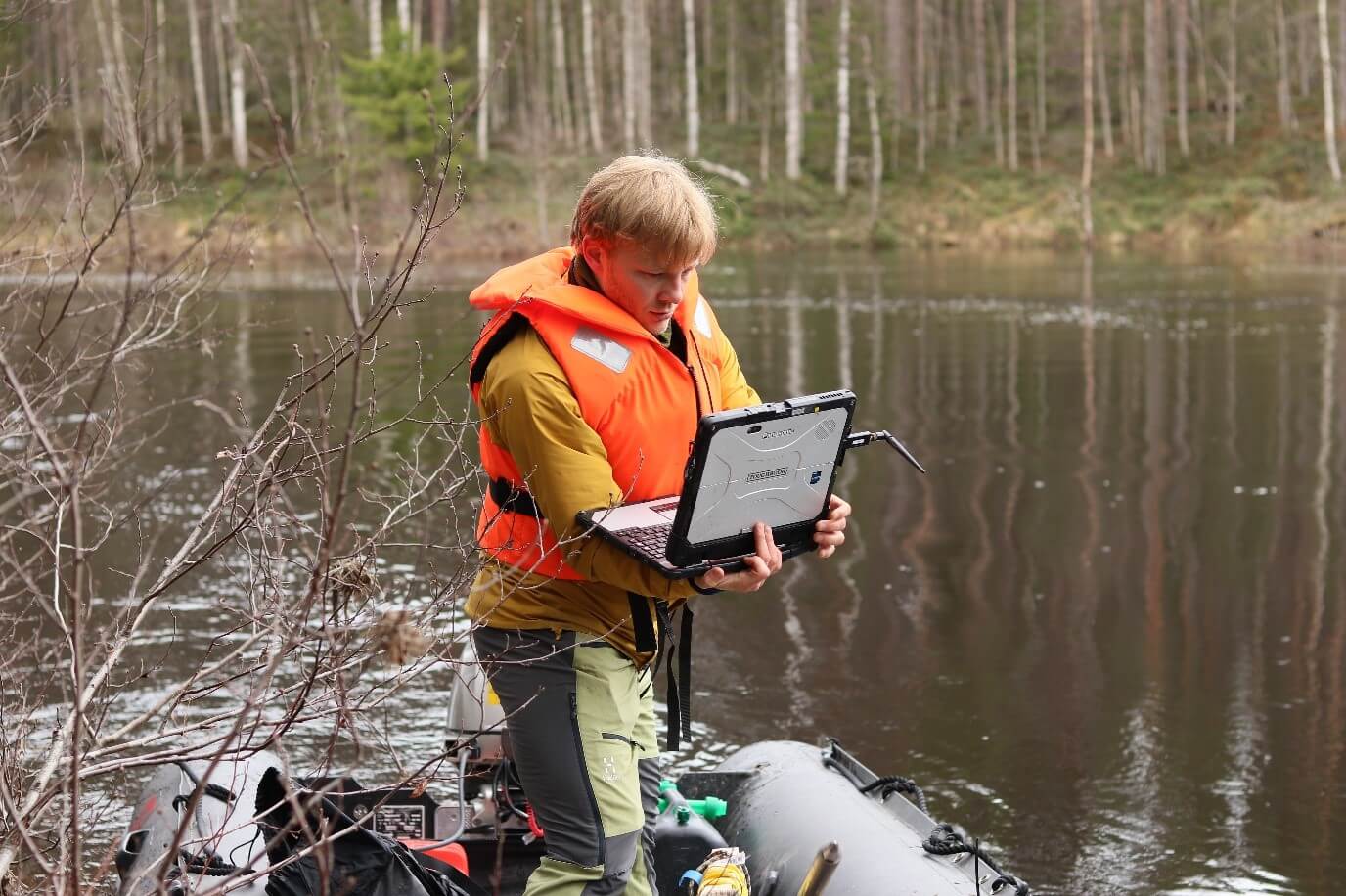
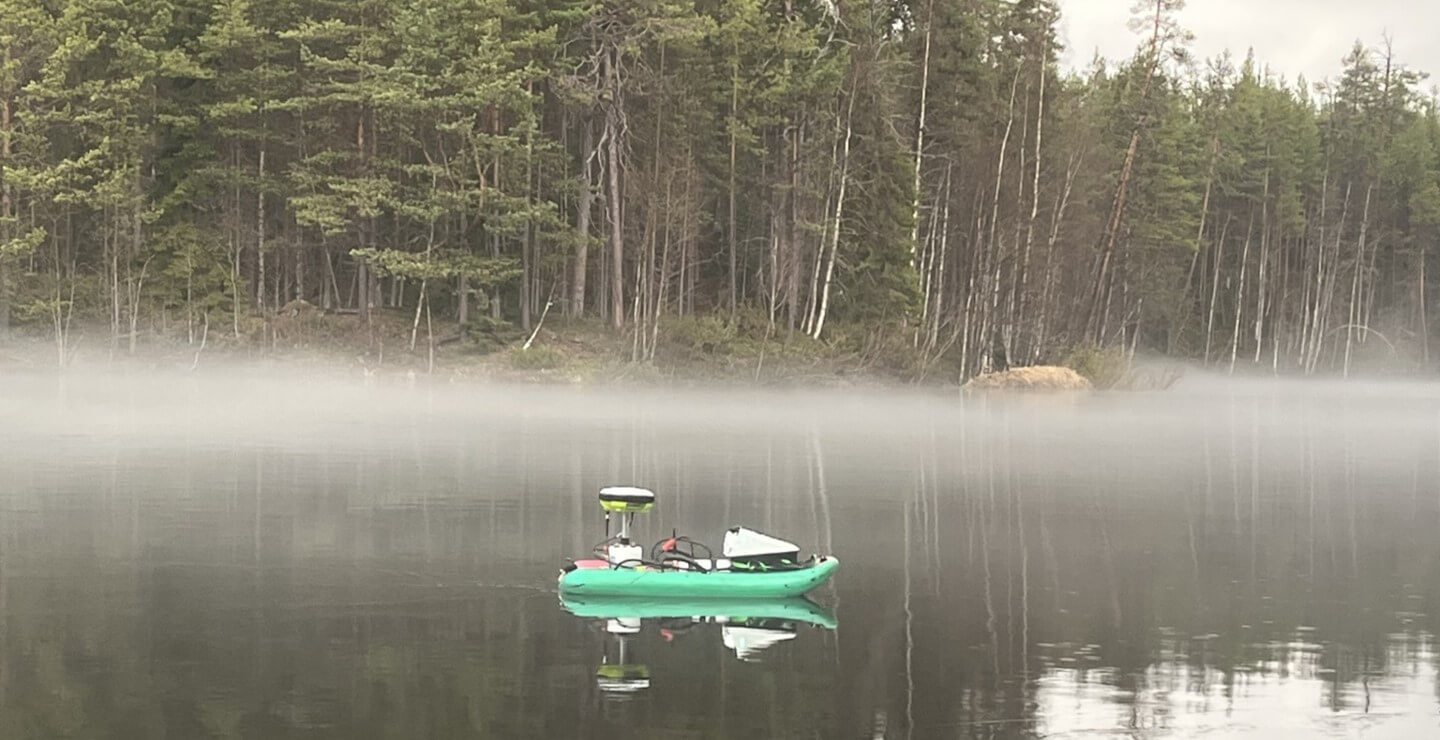
So, what do we actually do? We visit the DIWA supersites (Vantaanjoki, Oulankajoki, and Pulmankijoki) during winter, spring, and summer to see and measure the different conditions the rivers have due to the seasonality. During field campaigns our weeks are always fully packed: we install sensors to measure parameters such as water level and temperature, we need to maintain our previously installed equipment and if necessary transfer the data to our laptops, we use ADCP (Acoustic Dopler Current Profiler) for discharge measurements and bed profiles, we take sediment samples, measure bedload transport, use underwater drones under the ice cover, fly with sensor packed aerial drones, and more. The ADCP boat uses the reflection of acoustic beams on water particles to generate a velocity profile underneath the sensor. Together with specialized software, this can be transformed into river discharges and 2D flow velocity. The result? An enormous amount of data needs to be processed and analyzed once back in the office. The data is used to build physical-processes-based hydrologic models, train machine learning applications, and create an understanding of the variations and inner relations of the parameters.
Bringing our field campaigns to digital twins
My own research focuses on transferring the measured data to databases and digital twins and eventually to data users. Data pipelines and data processing are the keywords throughout my work so far. Data pipelines are needed to fluently, and in an automated way, get the data from the sensor into a virtual environment and to the scientific community or stakeholder end users. A big challenge in doing so is the differences in data formats and types between all measurements. There is temporal data from installed sensors that generate simple numeric output, but there is also data that needs to be subtracted from video imagery, acoustic signals, or needs some other form of pre-processing. Besides, the data can contain gaps (e.g., when sensors got broken or lost, or if batteries died) or other inconsistencies (e.g., strange values can be caused by drought or flooding events).
Digital twins offer a virtual environment supporting two-way data transfer to connect the physical world to scientists, modelers, policy makers, and other end users. Within this virtual environment, real-time data transfer can feed physical-based linked models, train machine learning applications, and create real-time visualizations. Two-way data transfer provides the possibility for users at all stages to make decisions and act on the latest information. A visual interface will display historical, current, and predicted conditions of our rivers and offer a platform to discuss management impacts based on measured and predicted parameters and in different scenarios.
My research focuses on this connection between the real and virtual worlds. And now, as a part of the DIWA Digital Twin Engineering team, I will also try to implement my work into the Digital Twin platform and hopefully contribute to a successful digital environment that will enlarge the impact of the Digital Water flagship program and bring our fieldwork to the DIWA community.
Unlocking Impact Through Collaboration
Digital Twins are a platform for communication between scientists, policy makers, local communities, industry, and other stakeholders. It is important that the platform serves the needs of all these users. While my focus is mainly data focused, I will try to understand the users’ needs and try to support them as much as I can with my contributions to the whole project. Luckily, many of you can help me in understanding the needs and to direct the work to have a full impact potential. If we can manage to bring all our work together, I can see great potential for our digital twins, support all the stakeholders’ needs, and make a great impact.
24.1.2026