Tuomas Haapala, Aalto University. tuomas.haapala@aalto.fi
“Man — despite his artistic pretensions, his sophistication, and his many accomplishments — owes his existence to a six-inch layer of topsoil and the fact that it rains.” – attributed to Paul Harvey
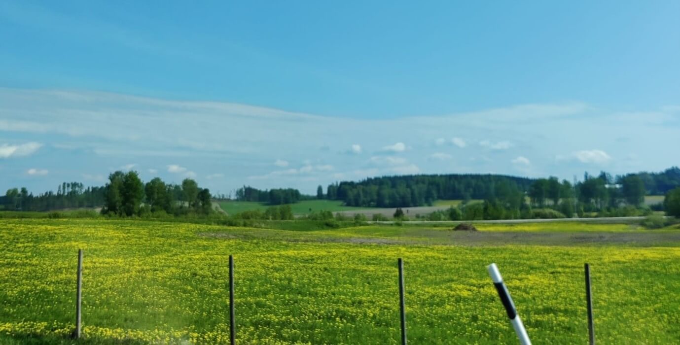
Agriculture is a combination of numerous natural processes and practices that provide us with food and resources. It is one of the oldest examples of how humans use technical knowledge over nature to our advantage, but agriculture nonetheless remains at nature’s whim. Agriculture struggles especially during the early summer months when seasonal precipitation and water storage from snowmelt are low. Although Finland has great surface water resources, their availability for irrigation varies due to regional differences and absent infrastructure [1]. Weather patterns greatly affect agriculture, and climate change can disrupt existing conditions towards uncertainty as heavy rains and periods of drought become more common [1].
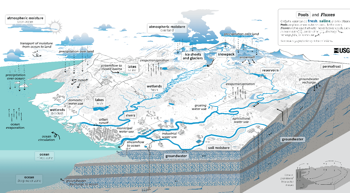
Agriculture’s intrinsic connection to water allows us to estimate agricultural conditions with the hydrological cycle. The hydrological cycle depicts the various water flows and their connections in the environment. The effects of climate change can be observed in the shifts of the cycle, such as changes in rainfall amount and occurrences, groundwater levels, and snow-cover. These properties are linked to each other and changes in one property affect the others. Understanding the dependencies between hydrological properties in different agricultural and environmental conditions allows researchers to improve agriculture’s resilience under climate change.
A modelling-based approach to connecting precipitation, groundwater, and climate
Several models exist to depict the hydrological properties moving from one stage of the hydrological cycle to the other. These computational models take meteorological and environmental data as their input data and simulate the rates at which water moves through the environment. Observations of the hydrological properties at simulated sites are then used to validate the models and ensure that their results are accurate.
When models are used with extensive, decade-long input datasets, it becomes feasible to assess long-term trends of change in hydrological properties, and crucially, whether these trends are reflected in the other hydrological properties. For example, do trends of precipitation result in corresponding trends of groundwater depth? Do trend directions or the simulated region have any relation to trend correspondence? Finally, could meteorological projections under climate change be used with this methodology to gain an understanding of future agricultural conditions?
Tracking Hydrological Change in Finnish Agriculture Using Open Data and Modeling
My research into the questions above relies on open meteorological data from the Finnish Environment Institute and field observations of soil conditions in Finland. On-site observations for relevant properties can be time-consuming and unfeasible, as historical datasets on individual sites are rarely available. Open data allows for a wide perspective and comparison between different regions of the Finnish agricultural area, though uncertainties in the data’s scale and compilation methods should be recognized.
Standardized indices for precipitation and groundwater (SPI and SGI) are used to designate dry and wet events in a given area, and their number of event occurrences and event lengths are used to identify changes over the input data timescale. A total of seven distinct locations in Finland are researched at the time for trend reflections, and their hydrological model results are under review. The first research location has so far shown that increasing trends for precipitation and groundwater depth coexist in Vaasa – one of the few locations in Finland where precipitation is expected to increase according to SPI analysis over 1980-2023. Other locations have similar distinguishing trend features. It is also possible to find other insights during the trend research – although an increasing trend exists for groundwater depth in Vaasa, the variance of the depth levels during summer is decreasing.
The desired impact of this research is to support farmers and the agricultural sector by identifying potential weak points and concerning trends in the hydrological cycle on a regional level. Irrigation is commonly used to supplement rainfall and groundwater storage in agriculture, but as warmer conditions become more common, the application of irrigation must be planned in detail to conserve water. Southwest Finland, one of the prominent agricultural regions of the country, is already considered to be vulnerable to droughts due to its large water usage [3]. As the open data and hydrological models already exist, it is imperative to use them proactively to prepare for the uncertainties of a warming world.
References
- Peltonen-Sainio, P., Hautsalo, J., & Melin, M. Ilmastonmuutos tuo maataloudelle sekä haasteita että mahdollisuuksia. (2024). https://www.luke.fi/fi/uutiset/ilmastonmuutos-tuo-maataloudelle-seka-haasteita-etta-mahdollisuuksia
- Photo 2. USGS. (2025). The Water Cycle. https://labs.waterdata.usgs.gov/visualizations/images/USGS_WaterCycle_English_ONLINE.png
- Winland-konsortio. (2019). Winland-hankkeen Policy Brief VII.. Kuivuus koettelee myös Suomea – Olemmeko tarpeeksi varautuneita? https://winlandtutkimus.fi/wp-content/uploads/2019/04/Winland-kuivuus.pdf
7.8.2025.