Ashutosh Laxman Taral, University of Oulu and Finnish Meteorological Institute. ashutosh.taral@oulu.fi
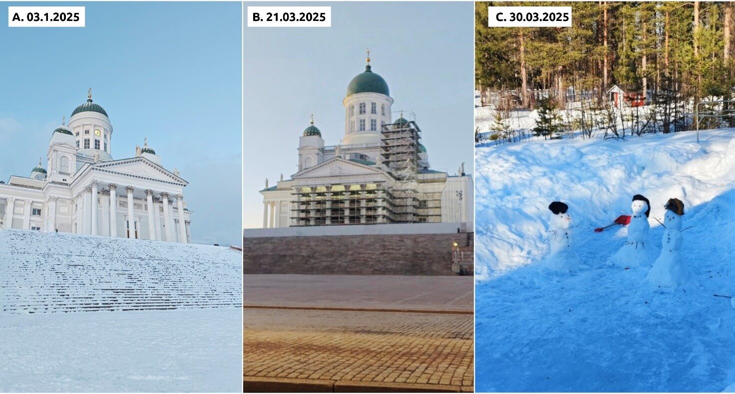
Snow is one of the most defining features of Finland. It shapes how we move, live, and make sense of the seasons. But snow also controls something most people don’t think about until spring arrives: how water flows through Finland’s rivers and lakes. Over the past decades, Finland’s winters have been warming, snow seasons have been shrinking, and snow melt has been happening earlier than before. We all see bits of this change in our daily lives, less stable winter weather, more slush, and unpredictable freeze-thaw cycles. But scientifically, we don’t fully understand how snow has changed across Finland’s landscapes over the last 30 years. That gap is what my PhD aims to fill. In the photos below, you can see how differently winter has behaved in the northern and southern parts of Finland at the beginning of the year 2025.
Snow is central to Finland’s hydrology and water resources
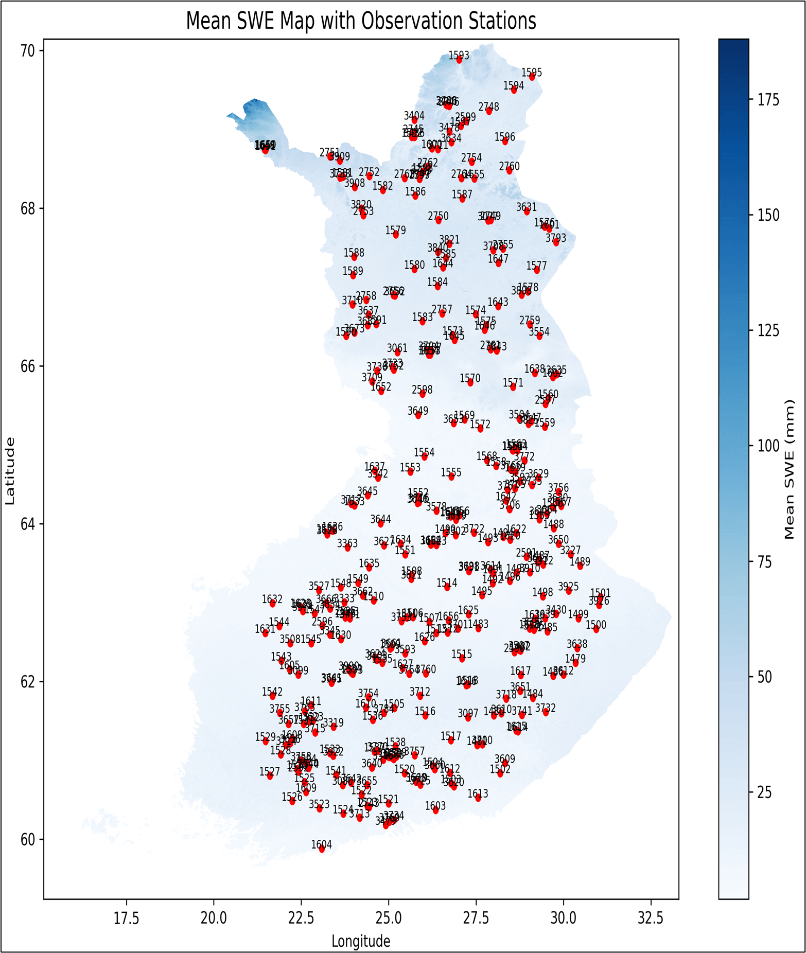
Snow acts as Finland’s water storage system. It builds up over winter and then releases water during spring melt, influencing river flows, flood risks, hydropower production, groundwater recharge, as well as wetland and lake ecosystems. A snowy winter can lead to a powerful spring flood season, but on the other hand, a low-snow winter can lead to less water and drier conditions later in the year. Since winters are warming, the timing and amount of the water are changing with consequences for communities, ecosystems, and infrastructure. Finland is fortunate to have decades of snow observations collected by the Finnish Meteorological Institute (FMI) and Finnish Environment Institute (SYKE).
However, the measurements are mainly taken at specific points on a map, often by hand, so they only represent certain locations. These measurements include the following:
- Snow depth – the vertical thickness of the snow layer on the ground, measured from the snow’s surface down to the underlying surface (ground, ice, etc.).
- Snow water equivalent (SWE) – the amount of liquid water contained within snowpack, and is determined by melting the snow and measuring the resulting water depth.
- Snow density – a measure of how much mass is in a given volume of snow.
The problem is quite simple: We don’t have a consistent, high-resolution, country-wide reconstruction of snow conditions across Finland over the past 30 years. Without the reconstruction, it’s hard to find an answer to big questions like “How have snow seasons changed regionally?” or “Where is snow disappearing fastest?”
SnowModel to simulate how snow accumulates, transforms, and melts
In my research, I’m using a SnowModel (Liston & Elder, 2006) to find an answer to the big questions I addressed. The SnowModel is a physically based model that simulates how snow accumulates, transforms, and melts based on weather data, land cover, and topography. For my research, I’m reconstructing Finland’s snow conditions from 1990 to 2021 using: NORA10 meteorological forcing Digital elevation data from the National Land Survey of Finland, and CORINE land cover. The SnowModel allows me to estimate snow depth, snow water equivalent, snow density, and snow melt timing at a high spatial resolution across all of Finland. I believe that at the end of my research, this research objective will most likely be one of the first full national-scale attempts.

Yet, models aren’t magic. They need real-world data to be trustworthy. Therefore, I use data assimilation, which essentially means feeding snow observations into the model to improve its accuracy and ensure it doesn’t drift away from reality. After this, I validate the results by using independent datasets to test how well the model captures Finland’s snow variability in both space and time. This helps to create a reconstruction that is physically grounded, data-informed, and scientifically credible, but is still capable of answering large-scale questions that observations alone cannot.
Why does my research matter for climate change in Finland?
Finland’s winter climate is changing, and with it, so is the entire structure of the hydrological year. Snow is turning into rain more often, spring is arriving earlier, and freeze-thaw cycles are becoming more frequent. These shifts impact, for example, flood risks, forestry, agriculture, and ecosystem stability, as well as the Finnish identity around winter landscapes. By reconstructing three decades of snow patterns, we can better understand how snow responds to warming, how regional patterns differ, and how water availability might shift in the future. This research is not only about scientific curiosity, but to implement adaptation planning whats to come.
References
- Finnish Meteorological Institute. (2021, March 26). Climate is the long-term average of weather conditions from https://en.ilmatieteenlaitos.fi/article/4L6Lvtx59IaAyeKGaDRsLo
- Kivinen, S., & Rasmus, S. (2015). Observed cold season changes in a Fennoscandian fell area over the past three decades. Ambio, 44(3), 214-225.
- Liston, G. E., & Elder, K. (2006). A distributed snow-evolution modeling system (SnowModel). Journal of Hydrometeorology, 7(6), 1259-1276.
- Luomaranta, A., Aalto, J., & Jylhä, K. (2019). Snow cover trends in Finland over 1961–2014 based on gridded snow depth observations. International Journal of Climatology, 39(7), 3147-3159.
- Pedersen, S.H., Liston, G.E., Tamstorf, M.P. et al. Quantifying Episodic Snowmelt Events in Arctic Ecosystems. Ecosystems 18, 839–856 (2015). https://doi.org/10.1007/s10021-015-9867-8
12.1.2026